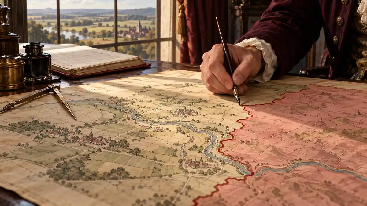
From the boundaries of the United States to land allotment in Indian Territory, imperial maps helped turn contested claims into practical authority. Their power lay in the institutions that used them—and in the rights those institutions could recognise, reshape or disregard.
In 1782, as British and American negotiators worked towards recognising the independence of the United States, they consulted versions of a map first published to strengthen Britain’s position in North America. John Mitchell’s enormous map had appeared in London in 1755, during the struggle with France over the continent. Twenty-seven years later, it helped the negotiators discuss the boundaries of a country breaking away from the British Empire. A map made in support of one political order had become useful in establishing another. Its original allegiance had proved less durable than its authority as a geographical reference.
There is a familiar criticism of imperial maps: their apparently dispassionate lines concealed political ambitions. Mitchell’s changing usefulness suggests a more demanding question. How did a particular representation become a reference that even opponents could share, and what happened to claims it could name without recognising on equal terms?
A map might locate an Indigenous community accurately while placing its territory inside somebody else’s dominion. Knowing a place, claiming it and governing it remained separate achievements. Their distinctions could become harder to see as a representation entered negotiations, administrative records and familiar accounts of territorial boundaries. Once an institution adopts a mapped claim as its working reference, challenging that claim means reopening what the institution treats as settled. The map helps determine where the argument starts.
A Map Changes Allegiance
Mitchell was a Virginia-born physician and naturalist who had settled in Britain. His cartographic undertaking developed under the patronage of the Earl of Halifax, president of the Board of Trade and Plantations. Engraved by Thomas Kitchin and published in eight sheets, the 1755 map assembled an imposing account of North America at a moment of sharpening Anglo-French rivalry. Its annotations defended British territorial arguments; in coloured impressions, boundaries and washes gave those arguments a readily apprehensible extent. Matthew Edney’s study of its publication shows how claims associated with Iroquois lands helped enlarge the territories assigned to Virginia and New York. Geographical learning supported a case for possession.
The distinction between displaying Indigenous peoples and recognising their authority is visible on the sheet itself. Names associated with Native communities coexist with the much larger territorial divisions asserted by colonial powers. Their presence supplies information about the continent without requiring the viewer to treat those communities as possessing an equivalent right to determine its political arrangement. A map can acknowledge that people are there while placing the power to dispose of their country elsewhere. The relevant silence concerns what their presence entitles them to decide.
When the peace negotiations took place in Paris, the parties used different versions of Mitchell’s map as a shared geographical reference for debating boundaries. The preliminary Anglo-American settlement was reached in November 1782; the definitive Treaty of Paris followed in September 1783. Its first article recognised American independence, while its second described the new country’s boundaries. No map was attached to the treaty or identified in its text. The agreement between Britain and the United States left the authority of Native peoples within that space unresolved.
The fighting that followed demonstrated the limits of that agreement. In 1791, a Native confederacy inflicted a devastating defeat on the American army commanded by Arthur St Clair. American victory at Fallen Timbers came in 1794, followed by the Treaty of Greenville in 1795 and substantial Native land cessions. These events were part of the struggle over what American claims would mean on the ground. The international settlement of 1783 had established a powerful diplomatic position, but securing control within the territory it described required further wars and negotiations. A later map could display the resulting boundaries while leaving those struggles outside the frame.
Mitchell’s map therefore presents two histories at once. One concerns the successful recognition of an independent state; the other concerns the unresolved distribution of authority within the recognised space. From the first perspective, the map helped make independence territorially intelligible. From the second, it carried forward a way of discussing land in which imperial rivals and their successor state occupied the principal seats at the negotiating table. A break in sovereignty could coexist with continuity in the geographical assumptions through which sovereignty was asserted. The map’s reuse allowed those assumptions to survive a change of sovereign.
Measured Ground, Unsettled Authority
The East India Company’s expanding power in South Asia developed through existing structures of authority as well as military force. In 1765, the Mughal emperor Shah Alam II granted it the diwani of Bengal, Bihar and Orissa: rights of revenue administration derived from an Indian imperial authority. This was an important constitutional relationship to remember when British images later presented Britain as the commanding presence in India.
Nor did the Company arrive in a landscape without geographical traditions. As the historian Baijayanti Chatterjee has shown, earlier Mughal descriptions, route knowledge and Indian maps formed part of the world in which European surveying developed. Works such as the Ain-i-Akbari, with its information about the Mughal realm, complicate any story in which geographical understanding began with British instruments. The Company’s surveyors worked with knowledge produced within political and intellectual traditions they had not created.
James Rennell’s Map of Hindoostan, published in 1782, made political ambition visible alongside geographical information. Its decorative cartouche shows Britannia receiving a Hindu religious text from kneeling scholars. A British lion places a paw upon a globe; commercial and military imagery surrounds the scene. Sabarish Suresh reads this composition in relation to the Company’s developing claims to legal authority.
The map’s colours distinguished British possessions from other powers, but the cartouche offered a broader image of British precedence. Its commanding figure and its geographical information belonged to the same published object. Technical knowledge could lend seriousness to the political vision, while that vision suggested who deserved to organise the world the map described. Britannia’s supremacy was an argument offered to the viewer, rather than evidence of a jurisdiction already established throughout the country.
The practical work of surveying was much less composed than this image. In Mapping an Empire, Edney follows the tension between British ambitions for a uniform geographical archive and their inability to achieve one. Route surveys, triangulation and the Great Trigonometrical Survey developed within institutions divided by administrative responsibilities, financial constraints and competing claims over information. The resulting maps emerged from compromises. The finished sheet could conceal gaps in knowledge, disagreements over procedure and the distance between an ideal survey and a workable publication.
Accurate measurement could improve geographical knowledge while serving an unequal political order. Reliance on Indian information could likewise coexist with British authority over its official classification. Precision answers some questions extraordinarily well: it establishes distances and corrects the position of rivers. It cannot establish, by the same operation, who ought to collect revenue, whose account of possession should prevail or what obligations a ruler owes the inhabitants. The danger lies in allowing confidence earned in measurement to settle an argument about authority. A line can be accurately placed and still represent an arrangement imposed through conquest; correcting its coordinates would leave the central dispute intact.
The Rights Inside the Grid
An allotment map preserved by the United States National Archives presents a quieter scene. Labelled as a township in the Chickasaw Nation, in Indian Territory—part of what became Oklahoma—it divides the land into a regular survey grid, then fills the divisions with names and numbers. Watercourses continue across the geometry. The political transformation is contained in what the grid has been organised to record: individually identifiable holdings within an administrative system. To understand the sheet, it is necessary to reconstruct the laws and decisions that made those entries possible.
The General Allotment Act of 1887 authorised the division of tribal lands into individual allotments, but expressly excluded several peoples, including the Cherokee, Choctaw, Chickasaw, Muscogee (Creek) and Seminole nations. Their later allotment followed a separate legislative and negotiating history. Established in 1893, the Dawes Commission initially sought agreements with these nations. The Curtis Act of 1898 authorised enrolment and allotment without their consent; subsequent agreements modified the arrangements.
The records reveal the connected administrative procedures: applications were assessed, approved names entered citizenship rolls, and approved enrolment established eligibility for allotment. Individual allotment files recorded land selections and legal descriptions; maps located the holdings within the surveyed territory. These documents performed related but different tasks. A boundary on a sheet could not by itself establish eligibility or complete the transfer of a legal interest. The operative power lay in the connection between the person recognised by the enrolment process, the parcel identified by the survey and the authorities empowered to approve the allocation.
The nations’ communal title already coexisted with individual cultivation and ownership of improvements. Allotment reorganised this system through individual allocations under federal authority. The map made the new units readily identifiable, while the surrounding legal machinery determined their status. A person seeking to secure an allotment had to deal with the institutions conducting it, however strongly that person opposed the wider transformation. Practical participation could become necessary to protect a particular interest without constituting freely given approval of the system.
The Choctaw record makes this tension concrete. The nation already maintained detailed citizenship records and had conducted regular censuses long before the Dawes Commission undertook its own enrolment work. Its General Council rejected changes to its lands in 1894. Positions nevertheless differed and changed: the pro-allotment Green McCurtain won the contested election of 1896, and Choctaw and Chickasaw delegates signed the Atoka Agreement in April 1897 under mounting federal pressure. The Choctaw Nation’s own historical account explains this turn partly as an attempt to shape the terms of a process Washington was pressing forward.
That history makes it untenable to describe allotment as the arrival of order on an administratively empty landscape. There were already governments, records and political arguments about land. The contest concerned which institutions would determine the governing arrangement and which records would carry decisive force. Once the new framework became operational, the earlier conflict could recede behind the apparent simplicity of a named parcel. What looked like a technical answer to the question “where is this person’s land?” incorporated a prior political decision about how land should be held and who could compel its division.
What a Forest Map Leaves Unresolved
The people contesting an official map may produce a map of their own. Doing so can reveal that land designated for one purpose is already occupied or used for another. The dispute then moves beyond what the land contains to whether the authorities will recognise those uses—and on what terms.
In her 1995 study of forest territories in Kalimantan, Indonesia, Nancy Lee Peluso examined challenges to official maps through what she called counter-mapping. In one case she described, government maps placed cultivated village land inside a nature reserve or timber concession. Community initiatives, often assisted by non-governmental organisations, used mapping to assert overlooked claims. These efforts brought existing uses into a form that could confront the government’s account of the same ground.
Yet customary rights did not always correspond to exclusive ownership of a bounded area: rights to particular forest products and uses could overlap. Translating them into territorial claims might help secure protection while changing their expression. Peluso’s analysis identifies a dilemma within a potentially valuable defence. The ability to submit a competing map matters, but so does the power to determine what kind of map will count as evidence. A more accessible procedure may still require people to reformulate their rights in categories determined elsewhere. They could gain a hearing while accepting restrictions on what their claim was allowed to mean.
Imperial Maps in One Colour
Maps intended for public circulation worked through another kind of compression. In July 1886, The Graphic published an Imperial Federation map showing the extent of the British Empire. British territories shared a conspicuous pink colouring; maritime routes and statistical information connected scattered possessions within a single world image. Across the top appeared the words “Freedom”, “Fraternity” and “Federation”. The common colour condensed relationships that differed profoundly in the authority Britain exercised and in the political rights available to inhabitants.
For the viewer, similarity arrived before explanation. Territory dispersed across oceans could be seen as parts of one entity, and shipping lines made separation look like connection. The world-map format allowed a far-reaching political and commercial system to be grasped at a glance. That convenience also made it possible to pass quickly over what membership in the system meant in each place and for different people living there.
The title added a political claim of its own. The Imperial Federation League, formed in 1884, sought to preserve imperial unity through federation. Captain J. C. R. Colomb’s accompanying essay argued that existing political machinery had failed to accommodate the empire’s growth. The image placed that existing empire beside an aspiration for its political organisation. Its apparent unity could serve as evidence for a future union, even though the desirability and terms of that union required argument. The map offered a way to see the proposal before it had been achieved. A contingent political future looked geographically available.
The decorations were the work of Walter Crane, whose socialism complicates a straightforward reading of imperial celebration. In her study of the map, Pippa Biltcliffe draws attention to the Atlas figure beneath the world, identified with human labour, and places the design within Crane’s wider commitments. Her interpretation reveals a political imagination in which criticism of exploitation could coexist with hopes for a reformed imperial association. Imperial imagery and aspirations for social reform occupied the same work. A publisher, an artist and a reader need not have understood every element in the same way, and the design cannot establish how persuaded its audience actually was. What it offered was a common world within which different imperial futures could be imagined.
After the Boundary Is Drawn
Reliable surveys can expose encroachment, agreed boundaries can restrain stronger neighbours, and mapped claims can give people evidence with which to resist dispossession. These possibilities make the institutions surrounding a map essential to its evaluation. A survey open to correction through evidence from those affected occupies a different position from one whose categories they have no effective power to challenge. More accurate information can strengthen a right, but it can also improve the administration of an arrangement that remains compulsory. The distinction lies in what a correction is allowed to change.
The most durable authority of imperial maps may emerge after their original arguments have ceased to be controversial among those empowered to act. Once an office uses a boundary as a routine reference, the immediate business concerns what lies inside it, how it is administered and which documents establish a claim. Recovering the earlier dispute takes additional work. A contingent settlement can acquire the appearance of geographical inevitability without anyone needing to repeat its first justification. The historical claim survives as a practical starting point, and those excluded from its making must begin their case against something that already looks settled.
Mitchell’s map remains instructive because its service to American independence did not cancel its imperial origins or settle the authority of the peoples represented within it. A map can assist a profound political emancipation while carrying assumptions that limit whose emancipation the new arrangement includes. When we look at its completed boundaries, the important history is not exhausted by discovering who drew the line. It also concerns who gained the right to treat that line as a starting point—and who, despite already inhabiting the country, was left having to argue from the other side of its authority.