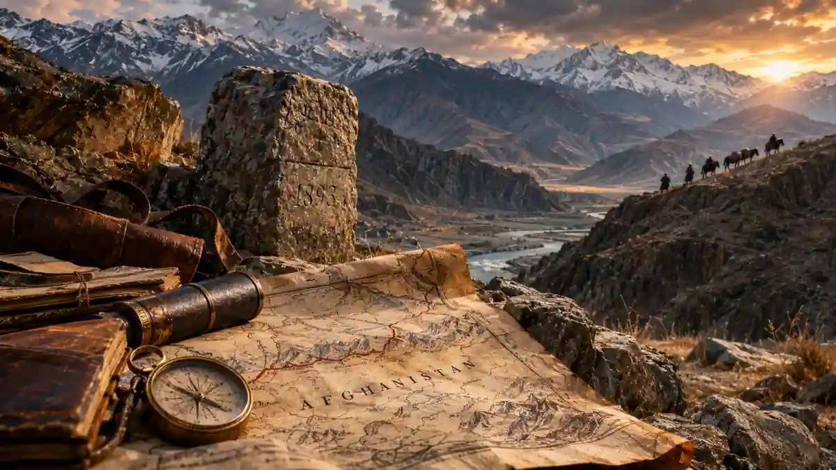
Afghanistan’s frontiers emerged through conquest, negotiation, arbitration and agreements made by Afghan governments themselves. Their different afterlives reveal why a boundary can become diplomatically settled yet socially disruptive—and why the disappearance of an empire rarely disposes of the arrangements it leaves behind.
In 1872, a British-led arbitration sought to divide Sistan between Persia and Afghanistan. Frederic Goldsmid’s mission had to translate competing claims to settlements, land and allegiance into a boundary. Its knowledge was incomplete: access to villages had been obstructed, population information was uneven, and parts of the proposed line had never been visited. Decades later, Henry McMahon, sent to address the problems that remained, criticised the earlier map as an inadequate sketch. A diplomatic decision had acquired authority greater than the geographical knowledge supporting it.
The episode, reconstructed by Arash Khazeni from the commissions’ records, exposes a difficulty running through the making of the borders of Afghanistan. Governments wanted identifiable limits to their obligations and ambitions. The people and resources being divided belonged to landscapes in which river channels moved, grazing required seasonal travel, and allegiance did not always establish exclusive possession of territory. Reaching an agreement could settle a question between officials while leaving its practical meaning uncertain.
Yet uncertainty did not give every frontier the same future. Northern boundaries survived the Russian Empire, the Soviet Union and the emergence of independent Central Asian states. Afghanistan and China formally settled their boundary through a bilateral treaty in 1963. Along the Iranian frontier, territorial arrangements acquired considerable durability while disagreements over water continued. The Durand Line became an inherited international frontier for Pakistan and a continuing object of Afghan political objection, while its enforcement increasingly disrupted relationships across it.
These differences require more than an account of imperial mapmaking. They require following what happened after a line was agreed: how it was located on the ground, incorporated into later agreements, maintained by successor governments and imposed on daily movement. None of those processes necessarily completed the others. A frontier could become harder to cross without becoming more politically accepted, or become less diplomatically disputed while continuing to divide people whose livelihoods depended on contact.
Before the Lines: Making the Borders of Afghanistan
The imperial history that preceded the Durrani state had produced overlapping connections among the Iranian plateau, Central Asia and the Indian subcontinent. Subsequent Afghan rulers inherited a political landscape organised around cities, agricultural districts, routes and relationships with powerful regional actors. Possession of a capital or the receipt of tribute did not establish an equally intensive government over every intervening valley. A ruler could claim territory whose inhabitants acknowledged him intermittently, through intermediaries or under particular circumstances.
The nineteenth-century contraction and reconstruction of Afghan power coincided with the expansion of neighbouring empires. Britain’s acquisition of territories in the subcontinent brought its authorities closer to the Afghan sphere. Russian advances through Central Asia transformed the position of khanates that had previously separated larger powers. The question became not simply which ruler could command a particular place, but where an advance would begin to threaten the interests of another empire.
The Anglo-Russian negotiations that produced the understanding of 1873 illustrate this change. London and St Petersburg sought to define the northern extent of Afghanistan as part of an effort to regulate their own rivalry. Russia’s subsequent expansion towards and beyond Khiva made the remaining ambiguities more consequential. An imprecise frontier between regional rulers became a potentially dangerous frontier between imperial systems.
Boundary-making offered an alternative to unlimited advance. If rival governments could agree where their respective interests stopped, they might reduce the occasions on which patrols, clients or commanders would draw them into a larger confrontation. The buffer state was valuable partly because it kept competing forces apart. Defining Afghanistan’s exterior could therefore serve imperial security even where neither empire intended to administer its interior directly.
Afghan rulers were constrained within this arrangement, especially while Britain restricted their external relations. Constraint nevertheless differed from complete political absence. They advanced claims, resisted proposals, appointed representatives and considered what territorial commitments would cost. Local chiefs and communities also affected what officials could establish through information, resistance, cooperation and the rights they asserted. Imperial power determined much of the negotiating field, but it still had to work through a country whose political and economic relationships exceeded its maps.
The distinction becomes clearer if four operations are kept in view. Delimitation agreed the course of a boundary; demarcation attempted to identify it through surveys and markers. Recognition and succession concerned how governments accepted or inherited the arrangement, while enforcement determined what crossing it required. These are familiar concepts in boundary studies, not successive stages through which every frontier must pass. Their value here is comparative: they prevent a date of signature from standing in for the whole history of a border.
The Northern Frontier: An Agreement Meets the Wells
The understanding reached through British and Russian correspondence in 1872–73 identified substantial portions of Afghanistan’s northern limits through the Amu Darya, then commonly called the Oxus in European diplomacy. Elsewhere, geographical descriptions and the naming of districts left considerable room for interpretation. An apparently recognisable place might denote a particular site to one party and a larger district to another. Agreement on a name did not necessarily mean agreement on the territory it contained.
Russian expansion made those differences harder to postpone. The occupation of Merv in 1884 brought Russian forces closer to areas claimed and occupied by Afghanistan. At Panjdeh in March 1885, Russian troops defeated Afghan forces and took the oasis. The crisis raised the possibility of an Anglo-Russian war, but negotiations produced a territorial compromise instead. Russia retained Panjdeh, while the subsequent settlement preserved other positions for Afghanistan.
The sequence mattered: troops changed possession before commissioners completed the line. The resulting diplomatic settlement did not simply discover a boundary already present in the landscape. It incorporated a distribution of military advantage and then sought to make that distribution manageable through protocols and survey work. British and Russian representatives negotiated formally, while the Afghan representative, Qazi Saad al-Din Khan, occupied a more restricted position.
The details could be surprisingly small beside the scale of the imperial confrontation. Daniel Balland’s reconstruction of the commission’s work shows negotiations turning on wells, irrigation, cultivated land and pastoral rights. A compromise in 1887 exchanged claims near the Amu Darya for territory in Badghis that included a well; demarcation continued into early 1888. A water point could determine whether patrols could operate and whether animals could survive. Strategic value was being produced through access to resources, not measured solely in square miles.
The northern boundary’s later durability was not immediate or automatic. The Soviet-Afghan treaty of 1921 left open a possibility of returning former Afghan frontier territories through a further agreement based on a plebiscite among their inhabitants. That provision was not implemented. A protocol accompanying the 1946 frontier agreement declared it expired, while the agreement established arrangements concerning river channels and islands. Further bilateral work developed the border’s administrative regime.
The documentary sequence assembled in the US International Boundary Study is therefore more revealing than a single imperial settlement. Later Afghan and Soviet governments revisited, specified and maintained the inherited boundary. What began through negotiations dominated by outsiders acquired additional foundations in agreements involving Afghanistan directly. The disappearance of the Russian monarchy did not erase the frontier, but neither did its survival require treating every nineteenth-century arrangement as permanently beyond negotiation.
After the Soviet Union dissolved, Afghanistan faced Turkmenistan, Uzbekistan and Tajikistan along the former Soviet frontier. The identities and interests of its neighbours changed much more dramatically than the broad territorial division. These boundaries have remained relatively settled as questions of interstate location, even when security, migration and access across them have been contentious. Diplomatic stability should not be confused with either an open frontier or an absence of hardship for the people living beside it.
This case also limits the appeal of a geographical explanation. Rivers supplied convenient reference points, but channels, islands and the political communities along them still required decisions. The boundary endured through repeated governmental action, not because the Amu Darya relieved governments of the need to agree. Its apparent naturalness was partly the result of institutions that made a particular interpretation of the river politically durable.
The Durand Line and the Meanings of Agreement
The southern and eastern frontier emerged from a different set of pressures. British authorities wanted to secure the approaches to India and regulate relations with communities beyond the territories they administered most directly. Amir Abdur Rahman Khan wanted clearer limits to British interference while preserving his own claims and strengthening his government. Their negotiations took place within an unequal relationship, but the amir had interests of his own in securing an arrangement.
Mortimer Durand’s mission to Kabul culminated in the agreement of 12 November 1893. Its preamble referred to the parties’ spheres of influence, language central to subsequent disagreement over what the document established. Its operative provisions also identified territorial limits, reciprocal commitments to non-interference and arrangements for demarcation. Reading only the preamble can obscure the obligations that followed it; reading the whole text does not eliminate the need to understand the different forms of authority then exercised along the frontier.
The agreement’s text also addressed local village rights during demarcation and included an increased British subsidy and assistance concerning arms. These provisions place the settlement within a practical bargain over territory, security and the resources of government. They support an account more specific than either unrestricted Afghan consent or an amir with no capacity to pursue a negotiated advantage.
The limits of foreign control were relevant to both parties. British influence over Afghan diplomacy did not amount to uniform British administration of the country, just as a British claim beyond the line did not imply identical government in every frontier district. The arrangement separated forms of intervention and authority that remained uneven on both sides. A political limit could be consequential well before a state possessed the personnel or infrastructure to regulate every crossing.
Demarcation during the following years exposed ambiguities in the agreement and its accompanying map. Commissioners had to translate a broad arrangement into particular valleys, ridges and village territories, and some disagreements persisted. The process divided communities and routes while leaving questions about access and jurisdiction unresolved.
The documentary history also extends beyond Abdur Rahman. Article II of the Anglo-Afghan treaty of 1921 expressly accepted the Indo-Afghan frontier already accepted in the 1919 settlement, subject to specified adjustments. That evidence makes the frequently repeated claim that no Afghan government ever accepted the frontier untenable without substantial qualification. Post-1947 objections must be examined alongside, rather than substituted for, the earlier record.
There are consequently several questions within the dispute. What obligations did the original agreement create? How did subsequent treaties affect them? What passed to Pakistan in 1947? What political and social claims persisted among people divided by the frontier? These questions overlap, but they cannot answer one another automatically. Historical acceptance does not establish present popular consent, and present political rejection does not by itself demonstrate that earlier legal obligations never existed.
Sistan: Keeping the Land, Sharing the Water
The western frontier complicates any account that treats the borders of Afghanistan as variations on the Russian-British confrontation. Persia asserted claims to Sistan, Afghan governments invoked their own history of possession, and local populations occupied a region whose economy depended on a river system crossing their rival jurisdictions. British arbitration entered this dispute through a particular diplomatic relationship. It did not simply reproduce the northern frontier’s division of imperial spheres.
Sistan’s land and water also resisted separation. Cultivation depended on diversions and channels; pastoral activity used areas whose accessibility changed with rainfall and inundation. Goldsmid’s 1872 award attempted a territorial settlement while preserving irrigation supplies on both sides. Subsequent changes in the Helmand’s course reopened questions about the relationship between a river channel and the line that officials had intended it to identify.
A channel abandoned by the river could remain legally significant while becoming less important economically. A new channel might sustain cultivation but create disagreement over jurisdiction or the legitimacy of a diversion. Khazeni’s account describes how floods, drought and rival works complicated the earlier settlement. By the time McMahon was assigned to the problem in the early twentieth century, boundary location and water allocation had become entangled questions requiring different kinds of decisions.
The ensuing work fixed a territorial interpretation and placed markers while addressing the water question separately. Other western sectors had their own histories: the MacLean arbitration concerned the northern section, and a Turkish mission under General Fahreddin Altay addressed remaining issues in the 1930s. The Afghanistan–Iran boundary study records this accumulation of awards, surveys and markers. Its significance is precisely that the western border was not completed by one British decision in Sistan.
Later governments could broadly accept where their territories ended while disagreeing sharply about the water needed within them. This was a partial achievement of boundary-making, not proof of its irrelevance. Distinguishing possession of land from entitlement to a flow allowed the dispute to acquire a different legal form. A settled frontier could still separate an upstream state with substantial practical influence from a downstream population vulnerable to shortages.
The Helmand River Water Treaty, signed on 13 March 1973, addressed delivery rather than redrawing the land boundary. For a normal water year, it specified an average flow of 22 cubic metres per second, with an additional four described as an expression of goodwill, distributed through a monthly schedule. It provided adjustments for lower flows, commissioners, measurement arrangements and procedures for resolving differences. Extreme drought required consultation rather than the assumption that normal conditions continued.
Those provisions made knowledge part of the allocation. To determine what was owed, the parties needed information about actual flow and the conditions defined by the treaty. A disagreement could therefore concern compliance, measurement or the interpretation of scarcity without amounting to disagreement over ownership of the riverbank. Hydrology did not remove politics; it specified some of the observations through which political claims would have to be tested.
This distinction remains essential when water tensions are described as another eruption along an unsettled Afghan frontier. The position of a boundary, the ownership of infrastructure and rights to water are related but separate matters. Conflating them makes every shortage appear to reopen the map and every accepted map appear to settle the shortage. Sistan demonstrates how a territorial settlement can endure while leaving governments with continuing obligations that require cooperation across it.
Wakhan: Separation as a Strategic Asset
Wakhan’s narrow projection towards China looks, on a modern map, like an exception demanding a simple explanation. Its history involves more than a strip inserted between two empires. The wider region contained principalities, communities and routes connected to Badakhshan, Bukhara, Kashmir and Xinjiang. The boundaries of authority were not identical to the enclosed corridor later made familiar through national cartography.
Hermann Kreutzmann’s account of the Wakhan quadrangle places those regional actors within competition among Afghanistan, China, Britain and Russia. Its central corrective is geographical as well as political: the Afghan corridor is the surviving cartographic form most people recognise, while historical Wakhan and its relationships extended beyond that shape. The population’s experience cannot be reconstructed solely from the space left between imperial claims.
The 1895 Anglo-Russian arrangements helped complete the northern limits of the Afghan buffer in the Pamirs. The territory’s usefulness to imperial planners lay substantially in keeping competing possessions apart. For inhabitants, mountains and passes connected grazing, cultivation and exchange; for distant strategists, a narrow intervening jurisdiction could prevent direct territorial contact. The same landscape could therefore be economically marginal in an imperial budget and strategically valuable in imperial diplomacy.
That value did not depend on a large population or a rich tax base. Separation itself was the asset. Assigning territory to an intervening state could serve the security of neighbours even when it complicated that state’s administrative responsibilities. A buffer’s convenience for the powers around it should consequently be distinguished from its convenience for the government expected to possess it.
The arrangements of 1895 did not settle the final Afghanistan–China boundary. The two governments signed their own treaty in Beijing on 22 November 1963. Its official text defined the line along watersheds and passes and provided for a joint commission, surveys, boundary markers and more detailed maps. The agreement was an exercise of bilateral Afghan diplomacy, however much its geographical setting owed to earlier imperial competition.
A demarcation protocol followed in Kabul on 24 March 1965. The US boundary study treated the boundary as established to both governments’ satisfaction while acknowledging limitations in the mapping available to outsiders. This is a useful qualification to the assumption that universal cartographic precision must precede a political settlement. The parties could accept an arrangement whose detailed representation remained imperfect elsewhere.
For Wakhi agriculturalists and Kyrgyz pastoralists, the consequences developed over a longer period. Research among these communities records how later closures restricted movement that had initially continued across the new political divisions. Fieldwork on Wakhi and Kyrgyz livelihoods makes mobility integral to the region’s economy rather than an accidental violation of its borders. Changes in enforcement could reduce the practical territory available to a household without altering the state’s mapped extent.
The comparison with Sistan is instructive. There, continued movement of water made an accepted territorial division insufficient. In Wakhan, restrictions on people and animals could make an accepted division increasingly consequential. Neither problem is explained by calling one boundary natural and the other artificial. Each depends on what has to move across the line for a society to function.
Pakistan Inherits a Frontier, Not a Consensus
Pakistan’s establishment in 1947 changed the political setting of the Durand Line. For the new state, the frontier was part of the territory and international position it inherited from British India. Afghan governments challenged that inheritance through claims concerning the line and the political future of Pashtun populations beyond it. An arrangement previously embedded in unequal Anglo-Afghan relations became a dispute between neighbouring states seeking to define their own sovereignty.
The transition also revealed differences among Pashtun actors. Abdul Ghaffar Khan’s Khudai Khidmatgar movement had developed through anti-colonial mobilisation and an alliance with the Indian National Congress. Its political trajectory cannot be reduced to the territorial ambitions of Kabul. Support for autonomy, an independent Pashtunistan, a united India or Pakistan represented different possible relationships between political community and statehood, not interchangeable expressions of a single ethnic position.
The 1947 referendum in the North-West Frontier Province offered accession to India or Pakistan, excluding an independent Pashtunistan or incorporation into Afghanistan. Ghaffar Khan’s movement boycotted it. A letter Gandhi sent him on 5 July 1947 discussed abstention, autonomy and the importance of avoiding violence against the Muslim League. The document captures political alternatives still being argued over, rather than a population speaking with one predetermined voice.
Pakistan won the vote, but the restricted options and boycott became part of the argument against treating the result as a comprehensive expression of regional preferences. Conrad Schetter’s study of the frontier’s changing character places Pashtun nationalism and subsequent Afghan claims within this contested transition. The question of who could decide was inseparable from the question of which alternatives were permitted.
State succession introduces another distinction. International law generally protects boundaries from being dissolved simply because one state replaces another in responsibility for territory. The International Law Commission’s commentary explains the rationale while explicitly leaving separate grounds for challenging a boundary untouched. This principle does not, by itself, adjudicate every historical objection concerning the Durand Line. It does mean that Britain’s departure cannot alone establish that the boundary ceased to exist.
Historical inquiry must therefore resist two shortcuts. Continued international operation of a frontier does not erase disputes over consent and self-determination. Political rejection by a government does not automatically invalidate the agreements through which the frontier developed. Elisa Giunchi’s research agenda on the dispute’s origins usefully separates questions about the 1893 bargain, nationalist claims and the referendum, rather than allowing one to stand in for all the others.
The enduring political difficulty lies partly in the difference between inheriting a border and inheriting agreement about it. Pakistan needed a defensible territorial settlement; Afghan leaders could invoke communities beyond the line as a matter of national concern. For border populations, either position might fail to answer a more immediate question: what access would remain to relatives, markets, work and land? The disappearance of colonial rule multiplied the claims made around the frontier rather than providing one accepted conclusion.
The Border Arrives at the Gate
A century-old boundary can acquire a new social force without moving. A fence redirects a journey towards an authorised crossing; a passport requirement turns a customary visit into an application; a closure converts a short commercial route into a loss of stock or income. These changes are exercises of contemporary state power. Their consequences cannot be attributed exclusively to the officials who negotiated the original line.
Research along Pakistan’s frontier with Afghanistan documents that transformation. The XCEPT and Asia Foundation study of cross-border mobility examined traders, transporters, travellers and resident communities through field interviews and observation. It found that documentation requirements, regulations and fencing disrupted employment and supply chains. Its researchers also identified other causes of disruption, including military operations and pandemic closures. The evidence supports a cumulative transformation of the border economy, rather than assigning every loss to the fence alone.
That qualification affects the analysis. A merchant with the documents and capital to use a formal crossing may experience regulation differently from a labourer whose earnings depend on frequent short trips. A household with access to transport may absorb costs that prevent another from travelling. Formalisation can redistribute opportunities towards people able to satisfy its requirements, even where its stated purpose is uniform administration.
Sabawoon Samim’s 2024 report for Afghanistan Analysts Network supplies a closer account from sixteen in-depth interviews with Afghan border residents. Respondents described disrupted family contact and ways of circumventing restrictions, with accompanying costs and risks. The sample cannot represent every border community, but it establishes mechanisms through which enforcement changes ordinary life. A relationship that once supplied practical help can remain emotionally important while becoming materially difficult to maintain.
Security concerns remain real, and residents have themselves suffered from armed groups and military operations. Yet the effectiveness of a restriction has to be assessed separately from its visibility. Governments can build an imposing barrier while imposing substantial burdens on legitimate travellers; a difficult crossing may remain usable by organised actors with money, local assistance or coercive power. Infrastructure demonstrates an intention to control movement, not the distribution of its actual effects.
Taliban rule after 2021 did not eliminate the interstate conflict around the frontier. The movement’s earlier relationships with Pakistan did not produce automatic agreement once it governed Afghanistan. In March 2026, UNAMA documented the humanitarian consequences of cross-border clashes, including civilian casualties, displacement and interruptions to assistance. The episode matters here because fighting and movement restrictions affected the same communities already required to organise life around the border.
These effects do not require each clash to originate in a disagreement over the line’s precise location. Militancy, security policy, crossing infrastructure and claims of sovereignty can generate confrontation around an established route. Calling all such violence a border dispute is descriptively convenient but analytically incomplete. The cause may concern what a neighbour permits or prevents within its territory rather than where that territory ends.
The practical frontier is consequently renewed through administrative decisions. Opening hours, accepted documents, permitted goods and the treatment of particular categories of traveller determine how a mapped division operates. For a border resident, these rules can matter more immediately than another statement about nineteenth-century validity. A line’s historical age tells us little about the age of the burdens currently imposed through it.
What Makes an Inherited Boundary Last?
Along the Afghan-Pakistani frontier, historical agreements and successor-state arguments have not produced a shared political account, while new barriers give the inherited line greater material force. Enforcement can proceed faster than reconciliation because one government can impose many restrictions without obtaining the other’s agreement. The resulting border may be more effective at separating people while becoming more resented as a political institution.
No single sequence explains these outcomes. A survey can follow an agreement or expose the need to renegotiate it; recognition can persist through changes of government; accepted boundaries can acquire new restrictions. What the cases share is the continuing work required to turn an inherited arrangement into a functioning relationship. The empire’s decision survives through later treaties, official routines, infrastructure and the choices of governments that may otherwise reject much of its legacy.
The Afghan state belongs within that later history. Its rulers were sometimes excluded from decisive negotiations and sometimes constrained within unequal bargains. They also concluded agreements, accepted adjustments, pursued claims and negotiated ways to manage shared resources. Restoring that agency neither excuses imperial pressure nor turns every Afghan decision into an expression of popular consent. It makes the history intelligible as a succession of political choices rather than the prolonged execution of one colonial command.
Goldsmid’s inadequate map offers a fitting measure of what changed. Knowledge that was insufficient to settle every local question could nevertheless help establish a framework within which future governments would make claims. Later officials repaired the survey, added markers, negotiated obligations and decided what movements to permit. The frontier endured because institutions kept using it, not because its first representation had been complete.
An empire can disappear while the authority to interpret its boundary passes into other hands. The decisive question then becomes who can turn that inherited line into a claim on land, a share of water, permission to travel or grounds for exclusion. Afghanistan’s borders have lasted through very different answers. Their survival records the persistence of a territorial framework; the lives organised around them reveal how profoundly its purposes can change.